I first started kayaking about 12 year ago. For most of
the following years I would go for a paddle about 2-3 times a year. I
introduced Linda to kayaking several years ago. This past winter I told her
that I wanted to buy my own kayak and asked her if she wanted to get one too
and she said yes but had some reservations that buying these boats might be a
passing interest. We never considered getting a tandem kayak. We like our
individual freedom.
We ended up buying two 14 foot boats. They aren’t as
stable as longer kayaks in the 17 foot range and more but they did come with
rudders which makes steering easy. We had to purchase a roof rack and the
accessories needed to put the kayaks on top of the car. Supposedly the kayaks
each way about 50 pounds but they seem much heavier if we have to carry them more
than several feet.
We also purchased life vests. Over the past few months we
have worked out a routine as to who looks after which chore when we load and
unload the kayaks from the car roof. It can take up to a half hour to lash
everything down. We don’t want to see our investment bouncing off the pavement
in the rear view mirror.
Spider
Lake
Spider Lake is about a 45 minute drive north on the
Island Highway from where we live in Lantzville just north of Nanaimo. I don’t
think the name of the lake has anything to do with lots of spiders being in the
area. It probably got its name because the lake has a number of arms. It isn’t
a big lake (about 65 hectares) but it sure is pretty. No power craft are
allowed and there are only a few cottages.
Usually there are a few people fishing for trout from
their kayaks, canoes, and sometimes in those floating angler chairs. It is
fairly common to see a fish jump out of the water. The lake has a number of
sandbars that make it easy to beach the kayak and have a snack or lunch.
I’ve kayaked Spider Lake 3 times including once with my
son Dean. Dean and I had an interesting conversation at the boat ramp with a
well-mannered guy in his early seventies who is still chasing women and smoking
cigarettes. I liked his spunk. Linda has kayaked at Spider Lake twice.
 |
| Dean. |
 |
| Deer. |
 |
| Sandbar. |
 |
| Me. |
Sproat
Lake
Sproat Lake is about a 15 minute drive west of Port
Alberni in the middle of Vancouver Island. It is a spectacular lake that is
about 25 kilometers in length. The water is very clear and you can see the lake
bottom from about 35 feet above. For some reason you don’t see minnows or other
small fish close to the shore but there are fish in the lake.
Sproat Lake was a place I wanted to kayak for a number of
years before we got our boats. We visited the lake twice this summer. There are
a number of magnificent country homes on the shores of the lake mostly in the
eastern area. It is quite common to see people water skiing and there are quite
a lot of power craft on the lake. In most cases the power boat operators are
quite courteous to paddlers and are aware that the big wakes left behind their
boats can bounce us paddlers around a bit.
On our first trip to Sproat Lake we launched our kayaks
at a provincial park boat ramp near the eastern tip of the lake. We checked out
some petroglyphs not too far away. We spent about 6 hours paddling that day
mostly about 100 yards or so off shore. We saw the Mars water bombers that for
a number of years helped fight wildfires in California.
I knew that the western part of Sproat Lake at the end of
Taylor Arm was more pristine with fewer cottages and was determined to get
there. We couldn’t find any road that looked like we could make it down to
Taylor Arm and we finally gave up and went to another lake not far away for the
day.
I still wanted to see the end of Taylor Arm and a week or
two later we went back to Sproat Lake. We knew we were in for a lot of kayaking
that day. As it turned out we kind of overextended ourselves. We made it most
of the way down Taylor Arm but not quite to the end. All in all we spent a
solid 7-1/2 hours paddling that day. We were exhausted when we finally made it
back to the boat launch. It was then that I discovered that the rear hatch on
my kayak was full of water. Apparently a rudder screw had come loose and the
water was leaking in through a quarter inch hole. It was like I had been
dragging an aquarium around with me and didn’t know it. We slept well that
night.
 |
| Summer house. |
 |
| Mars water bomber. |
 |
| Linda |
 |
| Linda and island. |
 |
| Vista. |
 |
| Linda |
Great
Central Lake
This was the lake we decided to kayak on when we couldn’t
find a road to Taylor Arm on Sproat Lake. It is about a 45 minutes west of Port
Alberni. Great Central Lake is about 45 kilometers long. It is the 2nd deepest
lake on Vancouver Island and has a maximum depth of about 965 feet. If you lose
your watch, car keys, or sunglasses overboard don’t bother going looking for
them.
The mountains go right into the lake which means that any
structures like cottages and boathouses are all floating. The water level is
controlled and the lake doesn’t freeze over in the winter. It is a very pretty
lake but we found that we couldn’t find anywhere to beach the kayaks.
 |
| Shoe tree. |
 |
| Old bridge. |
Genoa
Bay
Genoa Bay is one of the neatest little places on
Vancouver Island, about an hour’s drive south of where we live. It was where we
first launched our kayaks onto the ocean. Our original plan was to kayak from
Cowichan Bay to Genoa Bay but we found the sea to be too rough at Cowichan Bay.
The ocean was choppy at Genoa Bay too but we decided to give it a go and stay
mostly by the shoreline. From a distance we spotted the large house with the
green roof that a lady had given us a tour of some years ago. It was built
around 1890. We had a nice late afternoon meal out on the deck of a waterside
pub/restaurant.
 |
| Old House built around 1890. |
 |
| Coming in for a landing. |
 |
| Dog paddle? |
Comox
Lake
Comox Lake is about a 1-1/2 hour away from where we live
going north on Vancouver Island. You have to drive through the old coal mining
town of Cumberland to get there. It isn’t far from Courtenay, BC.
Strathcona
Provincial Park & Buttle Lake
Some friends of ours, Janet and Pennti, with a little Boler
trailer, were going camping up in Strathcona Provincial Park and asked us if we
would like to join them. Linda and I are not that big on camping anymore but I
really wanted to see the park as I had never been there before. We also wanted
to do some paddling in the park.
We worked out a plan. We have a golden retriever and dogs
and kayaks don’t mix, at least not for us. We would get up at the crack of
dawn, feed the dog and take him for a walk, get out on the highway and drive
for 3 straight hours and meet our friends at their campsite by Buttle Lake.
Strathcona Provincial Park is about an hour away from Campbell River. We would
have about a 5 hour window to visit and get in some kayaking before heading
back home and letting the dog out for a pee.
On our way to the campsite we stopped off at Strathcona
Lodge which isn’t in the park but close to it.
Strathcona Park reminds me a bit of the Rocky Mountains
with their snowcapped peaks. The scenery is breathtaking. The lake was a bit
wavy but we paddled across it and up the shoreline a bit. We spotted a turkey
vulture sitting in a tree. We beached our kayaks for about a half hour and I
saw a number of tree stumps. At first I thought the stumps were kind of like
picnic benches but then I learned that the lake was partly manmade and had been
harvested of its trees before it was flooded.
I put in about 6 hours of driving that day and I’d like
to go back and check some more things out in the area next year.
 |
| Buttle Lake. |
 |
| Kayak shack. |
 |
| Vista. |
 |
| Sailboat. |
 |
| Buttle Lake. |
Sandy
Island Marine Provincial Park
Sandy Island is sometimes also known as Tree Island. It
is a small island that sits off of larger Denman Island. It is uninhabited. It
takes about an hour and a half to paddle there from Union Bay on Vancouver
Island. I once owned a place just down the road from Union Bay at Fanny Bay. The
area holds a lot of fond memories for me.
I’ve probably kayaked to Sandy Island about a dozen times
over the years including with Linda and my son Dean. At low tide you can walk
from Sandy Island to Denman Island. The island has a nice sandy beach and sand
dollars can be seen close to shore. The far side of island is a bit more
rugged. Blue Herons can be seen stalking small fish. There are also a number of
tidal pools that can be investigated. I don’t think I’ve ever been to Sandy
Island without spotting a few seals.
When we told our friends Janet and Pennti that we planned
on spending a Saturday kayaking to and from Sandy Island they quickly told us
that they wanted to join us. The ocean was calm that Saturday which meant we
didn’t have to fight any waves. It was a very sunny day. I told Janet that she
might consider counting strokes because if you looked at the horizon the island
was a lot further away that it appeared.
We spent a few hours just taking it easy on the island.
Janet and Linda poked around some tidal pools. We ate our lunches sitting on a
log. Pennti discoverd some kind of plastic thing that looked like it might be
used for collecting clams or oysters. He attached the plastic thing to his
kayak on the way back and reminded me of Relic from the TV series The
Beachcombers.
We went for a bit of a tour around Fanny Bay including a
drive by of my old house, the oyster beaches, and The Enchanted Forest. They
didn’t know that what I showed them existed. I think a number of people have
driven by Fanny Bay thinking that there isn’t much there other than the FBI pub.
Little do these people know?
We stopped off at a roadside place that sells native
masks, pottery and ice cream cones. Linda and I once ran into the couple that
owns the place in Mexico.
Most summers in the recent past on Vancouver Island have
seen long stretches of continuous sunny weather. What makes it additionally
pleasant is there is almost always a light breeze. Any kind of breeze at all is
going to cause a bit of a chop in ocean waters. Sometimes that chop can make
ocean kayaking a bit more challenging particularly if the chop is going every
which way.
There are only a certain amount of days when the ocean is
totally calm and as smooth as glass. These are the perfect times to go ocean
kayaking. Last weekend was one of those times.
We live in Lantzville about 5 minutes from the ocean. A
few minutes away from us is Winchelsea Golf Course. There are spots on the back
nine holes of the course where you can see the Winchelsea Islands just off of
Lantzville. We have wanted to kayak in that area for some time but the weather
never seemed quite right.
Every once in a while we go down to the seashore in
Lantzville, often with our dog so he can have a swim. It’s about a 20 minute
walk and includes a trail through the forest. On warm summer nights a number of
people from Lantzville and surrounding areas bring along their lawn chairs to
watch the sun set. It’s a pretty mellow place.
This past weekend I noticed that there wasn’t the usual
breeze around and I thought that the ocean would be about as flat as it would
ever be. Lantzville doesn’t have a boat dock or boat ramp. We took our kayaks
down to Sebastian Beach in Lantzville at about 4 p.m. in the afternoon and
launched them from there. We were going to get in 3 or 4 hours of paddling, get
an up close look at The Winchleseas, and watch the sun set as we made our way
back to our starting point.
It was one sweet late afternoon and evening.
You may have taken the Duke Point ferry from just south
of Nanaimo to Tswawwassen just south of Vancouver. What you may not be aware of
(including a lot of people who live in Nanaimo) is that there are a number of
really beautiful spots on the other side of the peninsula from where the ferry
runs in an area called Cedar including The Crow and Gate Pub, Yellow Point
Lodge, and Cable Bay Trail.
2 weekends ago, when the weather was cloudy, we took our
dog along with us for a hike along the Cable Bay Trail. I also wanted to see
where the Cedar boat ramp was as I knew a number of kayakers launch their boats
from Cedar. We couldn’t find the ramp.
When we got home Linda googled the Cedar boat ramp and
made a copy of the directions of how to get there. Last Sunday we set off to
find the Cedar boat ramp. It turned out that we were pretty close to it the
weekend before. I guess I had expected to see a sign indicating where the ramp
is. There are no signs. Maybe it’s a local secret?
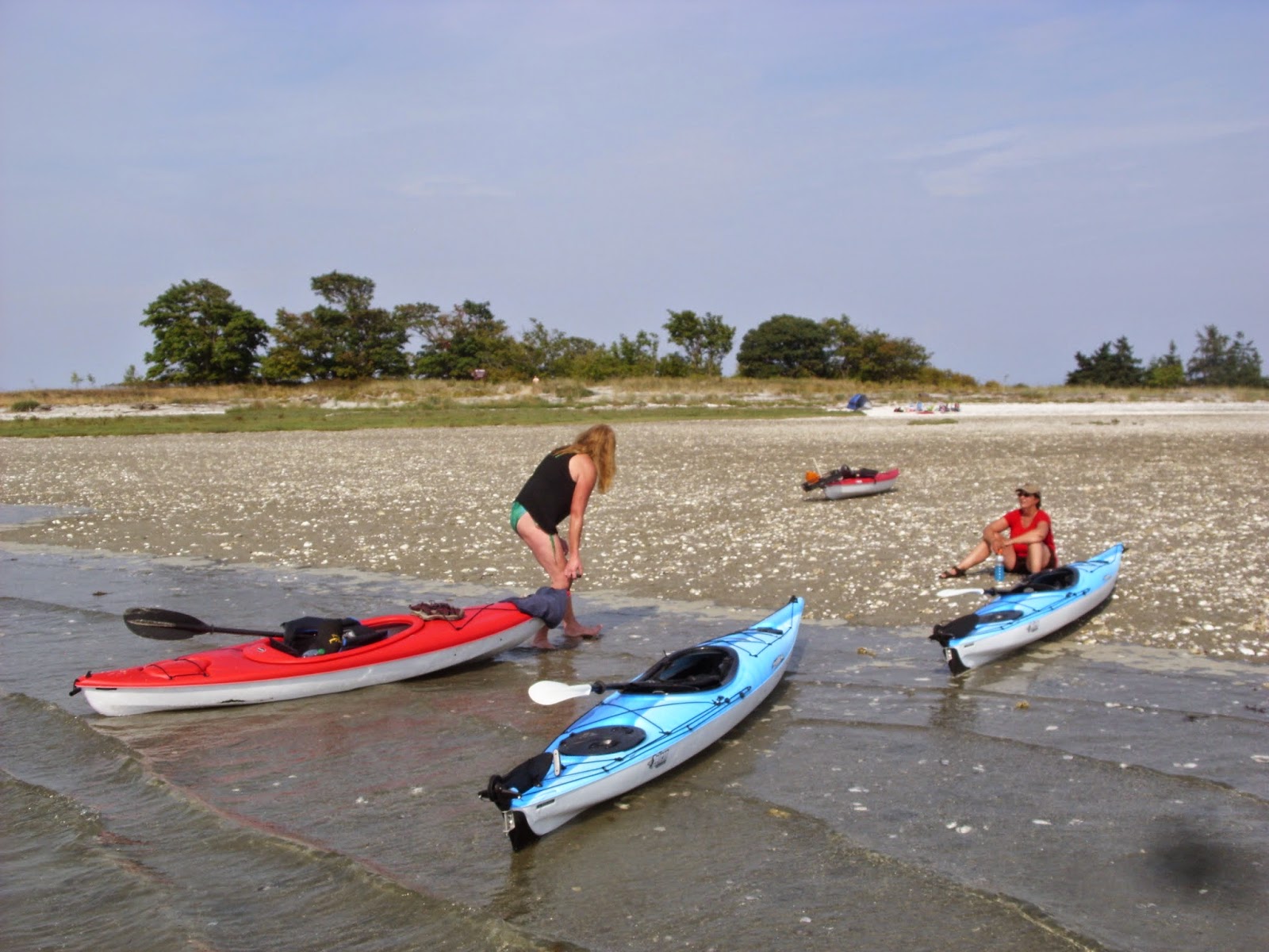
It was to be our second day in a row of kayaking on flat
ocean water. We checked out a small island, saw a few seals, and headed over to
a bigger island called Mudge Island. We found a nice spot to beach our kayaks
and have lunch. A number of other kayakers had the same idea.
After exploring the area for a bit we got back in our
kayaks and headed along the shoreline. We thought of going further along to an
area where the ocean narrowed but decided to call it a day and made our way
back to the Cedar boat ramp. We noticed several sailboats in the area that
seemed to be moored.
Our guitar teacher is a sailor and we asked him about the
area where the ocean narrows. It turns out that is called Dodds Narrows. Boats
that are not power crafts can only go through the narrows when the tide is at a
certain level and then only one at a time. Dodds Narrows leads into the harbor
at Nanaimo. Those sailboats that I thought were moored were actually waiting
for the right time to run through the narrows. Apparently kayakers could find
themselves in some difficulty if they chose to go through the narrows at the
wrong time.
 |
| Cedar boat ramp. |
 |
| Cormrrants. |
 |
| Mudge Island |
More
Kayaking
There are still several weekends before it gets too cold
for kayaking. If the ocean is fairly calm we might try and go over to Pirate’s
Cove on De Courcy Island. Otherwise we’ll find another lake to explore.